Gotta love PA

PA DETAILER

DETAILED TODAY?
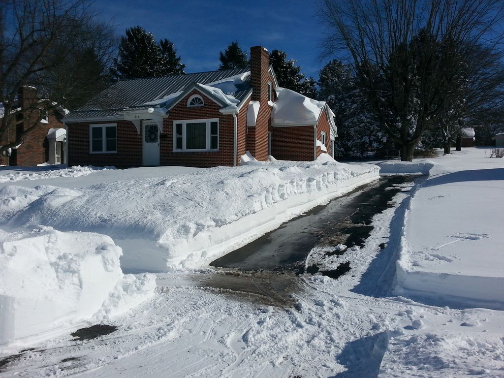
Gotta love PA weather...

... Winter weather advisory in effect from midnight tonight to 9 am est friday... The national weather service in state college has issued a winter weather advisory for snow, which is in effect from midnight tonight to 9 am est friday. * locations... Central mountains of pennsylvania and the middle susquehanna river valley. * hazard types... Snow. * snow accumulations... 2 to 4 inches. * timing... Snow will develop around midnight and continue into the mid morning hours on friday. The snow may be mixed with rain for about an hour after the onset. * impacts... The snow will create snow covered roads and hazardous travel conditions. Account for a longer commuting time to reach your destination. * winds... Northwest 5 to 10 mph. * temperatures... In the low to mid 30s. * visibilities... Mainly between 1 and 2 miles. However, brief periods of moderate to heavy snow could reduce the visibility to around one half of a mile. Precautionary/preparedness actions... The pennsylvania department of transportation reminds motorists to adjust speeds based on driving conditions and to take it slow in ice and snow. &&
 
IMG_5971_zpscuskzvuw.jpg
 
Wow, that was an interesting drive back from Corning, NY, which is right at the North Central PA line. There was many snow squalls driving 15 South into Williamsport, Shmokin Dam, and into Marysville. It had snowed pretty good here at home in Fulton County, but alot of it had melted by the time I got home.
 
We only got maybe an inch here in the Harrisburg, PA, area -Nizmo, you weren`t too far away in Marysville! -- but none of it stuck. I`m a little worried about the potential nor`easter early next week. Glad I didn`t put the snowblower away.

More and more I keep thinking I`ll move to Phoenix where family and friends are...

Gordon
 
They are warning us this coming Tuesday could be a nor`easter, depends on the storm track. If its the jackpot track could see 1-2 feet of snow. hey winter stick it where the sun dont shine. Oh wait thats right where it is going to hit, damn you Al Gore we need global warming FAST!!!!!!!!!!!
 
We only got maybe an inch here in the Harrisburg, PA, area -Nizmo, you weren`t too far away in Marysville! -- but none of it stuck. I`m a little worried about the potential nor`easter early next week. Glad I didn`t put the snowblower away.

Going through Marysville (and about 45 min from where I live) is a very traveled route for us driving to parts of NY or Williamsport. GPS always wants to take us to 322, HA, NOPE!

Curious myself about the impending Nor-easter. Not sure if the boss is going to have us out of town; would make it difficult for the ladies at the house to get out. I have a snow-blower, but with one just having a hip replacement and the other severe arthritis, they ain`t running it. Luckily my neighbor across the street would help them out.
 
Gordon, I am only a little north of Harrisburg, Dauphin area and we got about 3 1/2 inches, even had trees down due to the weight of the snow!!

I agree about the inch, cause I visited my brother in Colonial Park and that is what he had on his lawn.
 
They are warning us this coming Tuesday could be a nor`easter, depends on the storm track. If its the jackpot track could see 1-2 feet of snow. hey winter stick it where the sun dont shine. Oh wait thats right where it is going to hit, damn you Al Gore we need global warming FAST!!!!!!!!!!!
There is nothing like a blizzard after switching to Daylight Saving Time. :P
 
They are warning us this coming Tuesday could be a nor`easter, depends on the storm track. If its the jackpot track could see 1-2 feet of snow. hey winter stick it where the sun dont shine. Oh wait thats right where it is going to hit, damn you Al Gore we need global warming FAST!!!!!!!!!!!

Heard the same! Calling for a major event.
 
Getting closer to the potential "Noreaster" Reports for expected snow in my county range from 6"+ to 10"-14". We`ll see as we get closer. Gotta find a parking spot for my truck; the town kinda frowns upon vehicles parked on the street during storms. Probably going to be out of town, so I`m not sure how I`ll get back in my driveway come Friday since temps are staying low all week.

As long as it don`t do what it did last year...

20160124_121555_zpswn0kival.jpg
 
The latest update...

... WINTER STORM WATCH IN EFFECT FROM MONDAY EVENING THROUGH TUESDAY EVENING... THE NATIONAL WEATHER SERVICE IN STATE COLLEGE HAS ISSUED A WINTER STORM WATCH, WHICH IS IN EFFECT FROM MONDAY EVENING THROUGH TUESDAY EVENING. * LOCATIONS... LAUREL HIGHLANDS... WEST CENTRAL AND NORTHWEST MOUNTAINS * HAZARD TYPES... HEAVY SNOW AND POTENTIAL FOR BLOWING AND DRIFTING SNOW. * SNOW ACCUMULATIONS... POTENTIAL FOR 6 OR MORE INCHES OF SNOW... EXCEPT 8 INCHES OR MORE OF SNOW EXPECTED ON RIDGETOPS AND PORTIONS OF THE NORTHWEST MOUNTAINS AND LAUREL HIGHLANDS. * TIMING... SNOW WILL BEGIN MONDAY EVENING FROM WEST TO EAST. THE HEAVIEST SNOW WILL OCCUR LATE MONDAY NIGHT AND OVERNIGHT INTO TUESDAY. * IMPACTS... HEAVY SNOW MAY CAUSE SIGNIFICANT TRAVEL DISRUPTIONS, DANGEROUS TRAVEL CONDITIONS AND ISOLATED POWER OUTAGES. * WINDS... NORTHEAST 10 TO 15 MPH WITH GUSTS UP TO 30 MPH. PRECAUTIONARY/PREPAREDNESS ACTIONS... REVIEW WINTER WEATHER SAFETY AND PREPAREDNESS INFORMATION AT WEATHER.GOV/WINTER. &&
 
Yeah forecast for our work area is 6"-18"+ depending on storms track with wind gusts 45-65 mph. Starting here sometime between Tuesday 4 am - 8 am depending which forecast system you believe. Either way we are screwed we are under a Blizzard watch as of now. We will work 14-15 hours Monday and try to pull ahead and get as much of Tuesdays work done as we can. I am so bummed out right now I just cant take anymore winter.
 
In the event I`m home I made sure the snowblower works, also moved the truck off the street. Unfortunately it`s half in the yard, but not much I could do about that. Predicted snow totals keep going up...
 
Back
Top